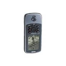
GPSMAP 76 - Marine, hiking GPS receiver - 2.9" mon
Model: 240
Brand: Garmin
The GPSMAP 76 is designed to provide precise GPS positioning using correction data obtained from the Wide Area Augmentation System. This unit features a built-in quad helix antenna for superior reception and can provide position accuracy to less than three meters when receiving WAAS corrections. The GPSMAP 76 has an internal memory capacity of eight megabytes. In addition, it comes with a built-in basemap of cities, coastlines, lakes, rivers, interstates, and interstate exit information and a database of nautical navaids. This unit has eight megabytes of internal user memory for storing optional MapSource - detailed maps, including marine cartography. This memory is preloaded from the factory with worldwide cities (populations greater than 200, 000) and nautical navigation aids such as lights, buoys, sound signals and day beacons. The GPSMAP 76 is also preloaded with tide data for the United States. An extra-large display measuring 1.6\"W x 2.2\"H gives users a clear view of information, while a waterproof case means the GPSMAP 76 will keep working well even if it has been submerged in water. Even more amazing, this unit will actually float if accidentally dropped in the water. « less
Product Specifications –
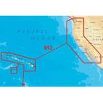
- Preloaded Maps : North America, South America
- Part Numbers : 010-00249-03, 010-00249-04, 76
- Protection : Waterproof
- Product Type : GPS receiver
- Recommended Use : Marine, hiking
- Receiver : 12 channel
- Resolution : 240 x 180
- Routes : 50
- SBAS : WAAS
- Run Time (Up To) : 16 hours
- Tracks : 10
- Tracklog Points : 10000
- Trip Computer : TracBack, average speed, maximum speed, trip timer, trip distance, sunrise/sunset times, sun/moon positions
- Type : AA type
- Type : LCD - monochrome
- Update Rate : 1/second
- Waypoints : 1000
- Waypoints per route : 125
- Width : 2.7 in
- Weight : 7.7 oz
- Warm : 15 sec
- Waterproof Standard : IPX7
- Max Operating Temperature : 158 °F
- Min Operating Temperature : 5 °F
- Interfaces : Serial - RS-232 Antenna - MCX
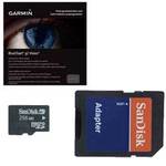
- Internal Memory : 8 MB flash
- Interface : Serial, NMEA 0183, RTCM SC-104 DGPS
- Included Software : Garmin Marine Point Database (Americas), Garmin Americas Highway Basemap
- Height : 6.2 in
- Included Accessories : PC cable, wrist strap
- Features : Optional external GPS antenna connection, calendar
- First Seen On Google Shopping : April 2007
- Functions & Services : MOB (Man Overboard), speed
- Grids : UTM, MGRS, Lat/Lon, UPS, User, Loran TDs, Maidenhead
- GTIN : 00025282046195, 00053759045099, 00689076139540, 00753759029456, 00753759029463, 00753759029616, 00753759029623, 00753759031084, 00753759032029, 00753759034924, 00753759041939, 00753759045098, 00753759045104, 00753759045470
- Display Illumination : Yes
- Depth : 1.2 in
- Diagonal Size : 2.9"
- DGPS : DGPS ready
- Design Features : Rugged case
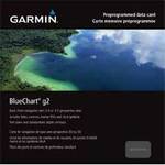
- Compatible Software : MapSource BlueChart, MapSource Fishing Hot Spots
- Cold : 45 sec
- Antenna : Built-in
- Accuracy : Position - 49 ft Position - 10 ft ( with WAAS ) Position - 10 ft - 16 ft ( with DGPS ) Velocity - 0.16 ft/sec